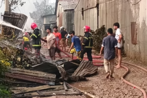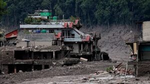
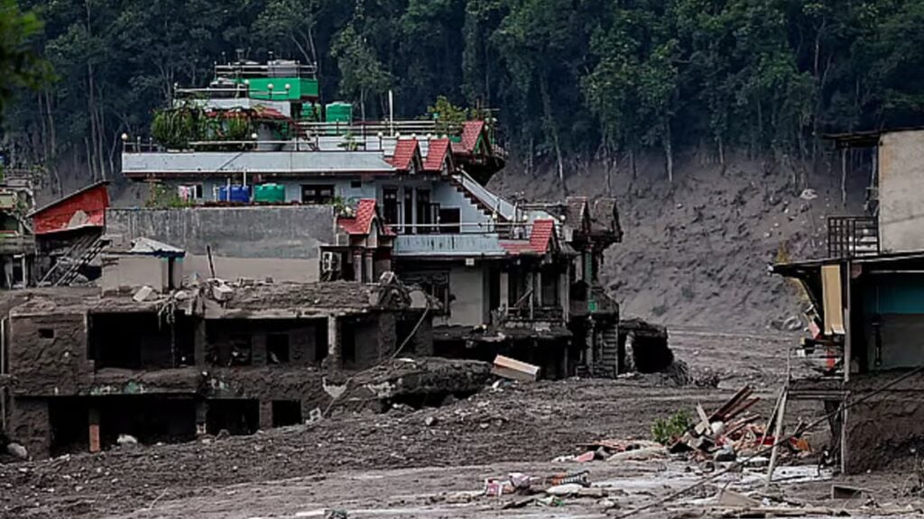
A devastating combination of flash flooding and landslides has struck a mountainous area of Nepal near the Tibetan border, sending torrents of mud, water, rocks and debris through settlements with little warning. Homes, roads and vehicles were swept away within moments, leaving many residents with virtually no time to reach safety.
At least 162 people have reportedly died, while around 1,500 remain missing, according to Reuters. Among those reported missing are about 800 foreign nationals, adding an international dimension to an already severe disaster.
Scientists have yet to establish a definitive cause. Early assessments, however, are focusing on the possibility that a major landslide blocked a river, creating a temporary natural dam. If water accumulated behind the obstruction before the barrier suddenly collapsed, the resulting surge could have produced the destructive flash flood that struck downstream areas.
The remote and complex terrain of the Himalayas makes such events particularly difficult to predict. Rivers often run through narrow valleys, while unstable slopes, snow and ice can rapidly alter the landscape.
Did the landslide trigger the earthquake?
In the immediate aftermath, Nepal’s Foreign Minister Shishir Khanal suggested that an earthquake may have triggered the landslide. His explanation was that a landslide could have blocked a river, effectively forming a natural dam. Once that barrier failed, a large volume of water could have rushed downstream and caused severe flooding.
An analysis by the United States Geological Survey, however, raised a different possibility. The agency detected a magnitude 4.4 earthquake in the area. While the initial assumption was that the earthquake had caused the landslide, subsequent analysis suggested that the landslide itself may have generated the seismic signal.
That distinction could prove important in determining how the disaster unfolded. Establishing the sequence of events requires detailed examination of seismic data, satellite imagery, terrain changes and the condition of the river system.
Preliminary observations by the International Centre for Integrated Mountain Development, based in Kathmandu, also found no clear evidence of a major abnormal event on the Chinese side of the border. Sarthak Shrestha, a geospatial analyst at the organisation, suggested that a large collapse involving rock and ice on the Nepali side may have blocked the river. Such an obstruction could have caused the sudden flooding of the Lende River.
Why was the flooding so severe without heavy rain?
One of the most striking features of the disaster is the apparent lack of significant rainfall immediately before the event.
In ordinary river flooding, prolonged or intense rainfall is often a major factor. Here, however, the scale of the flooding appears difficult to explain through rainfall alone. Hatim Sharif, a hydrologist at the University of Texas at San Antonio, described such severe flooding following limited rainfall as highly unusual.
A sudden change in the course of a mountain river can also undermine conventional flood-warning systems. Rain-based warnings generally depend on monitoring precipitation and river levels over time, giving communities at least some opportunity to respond. A landslide-generated flood can develop much more abruptly.
Once a natural barrier gives way, water may rush downhill carrying enormous quantities of mud, boulders and other debris. Such a mixture can behave more like a dense, fast-moving mass than ordinary floodwater. Roads and vehicles therefore offer little protection, while escape on foot may become impossible once the flow reaches populated areas.
In these circumstances, reaching higher ground as quickly as possible can be critical.
Further flooding may still be possible
Concerns have not ended with the first wave of destruction. Some upstream sections of the river system may still be obstructed, raising the possibility that water could accumulate again.
Chiangong Zhang, head of climate and environmental risks at the International Centre for Integrated Mountain Development, warned that water trapped upstream could potentially produce another powerful surge if an obstruction fails.
Dorothy Heinrich, a researcher at the University of Reading in the United Kingdom, has also highlighted the particular vulnerability of Himalayan rivers. Many flow through narrow, steep-sided valleys where landslides or avalanches can temporarily block their channels.
When that happens, water can build up behind the blockage. A sudden collapse of the barrier can then release the stored water rapidly downstream, producing a destructive flood with little warning.
Climate change remains an open question
Scientists are not yet in a position to establish a direct link between climate change and the latest disaster. Determining whether a changing climate contributed to this particular event would require further scientific investigation.
There is, however, growing concern about long-term environmental changes across the Himalayan region. Rising temperatures are contributing to glacier retreat and changes in snow and ice conditions. These processes can affect the stability of mountain slopes and alter the behaviour of high-altitude water systems.
One potential hazard is the formation of glacial lakes as ice melts and water accumulates behind natural barriers. If such a barrier fails, a glacial lake outburst flood can send a large volume of water downstream with devastating consequences.
Nepal and other Himalayan countries are exposed to several overlapping hazards, including landslides, glacier-related flooding and sudden changes in mountain river systems. Yet there is no evidence at present that a glacial lake outburst flood was directly responsible for this particular disaster.
Nepal has experienced similar sudden flooding before. In July last year, a powerful surge originating from China’s Gyirong area struck Rasuwa district in Nepal. The earlier event has added to wider concerns about the vulnerability of communities living along Himalayan river valleys.
Scientists seek clearer evidence
Researchers are expected to gather more evidence to reconstruct exactly what happened during the latest disaster. Satellite observations, geological surveys, seismic records and hydrological data could help establish whether a landslide blocked the river, how long the obstruction lasted and what caused it to fail.
Scientists may also examine whether changing climatic conditions have altered the likelihood or intensity of such events. Such research can compare the probability of extreme mountain hazards under today’s warmer climate with conditions before the industrial era.
For communities living in the Himalayas, the findings could have practical consequences. Rainfall forecasts alone may not be sufficient to detect every dangerous flood. Monitoring mountain slopes, glaciers, snow and ice, river channels and potential natural dams may also be necessary.
The disaster has therefore raised questions extending beyond the immediate loss of life and destruction of infrastructure. It has highlighted the unpredictable behaviour of Himalayan rivers and the difficulty of forecasting hazards that can develop within minutes.
Improved early-warning systems, closer monitoring of unstable terrain and rapid communication with communities in exposed valleys could become increasingly important as countries across the Himalayan region seek to reduce the human cost of future disasters.