Thursday, 21st May 2026

Khabor Wala Desk
Published: 18th August 2025, 9:24 AM
Hurricane Erin, downgraded to a Category 3 storm on Sunday, continues to batter Caribbean islands with heavy rain, prompting warnings of flash floods and landslides. Forecasters caution that the hurricane is expected to intensify and expand in the coming days.
This marks the first hurricane of a forecasted particularly active Atlantic season. Erin briefly reached Category 5 – “catastrophic” status before its winds weakened.
| Location | Status | Warnings / Notes |
| Southeast Bahamas | Tropical storm warning | Monitor for flash floods |
| Turks and Caicos Islands | Tropical storm warning | Monitor for flash floods |
| North Carolina Outer Banks | Advisory | Monitor Erin’s progress |
| Bermuda | Advisory | Monitor Erin’s progress |
| Central Bahamas | Advisory | Monitor Erin’s progress |
As of 5:00 pm Atlantic Standard Time (2100 GMT), Erin was located approximately 275 miles (445 km) north of San Juan, Puerto Rico, with maximum sustained winds of 125 mph (205 km/h), according to the Miami-based National Hurricane Center (NHC).
“The core of Erin is expected to pass to the east and northeast of the Turks and Caicos Islands and the southeastern Bahamas tonight and Monday,” the NHC stated in its latest update.
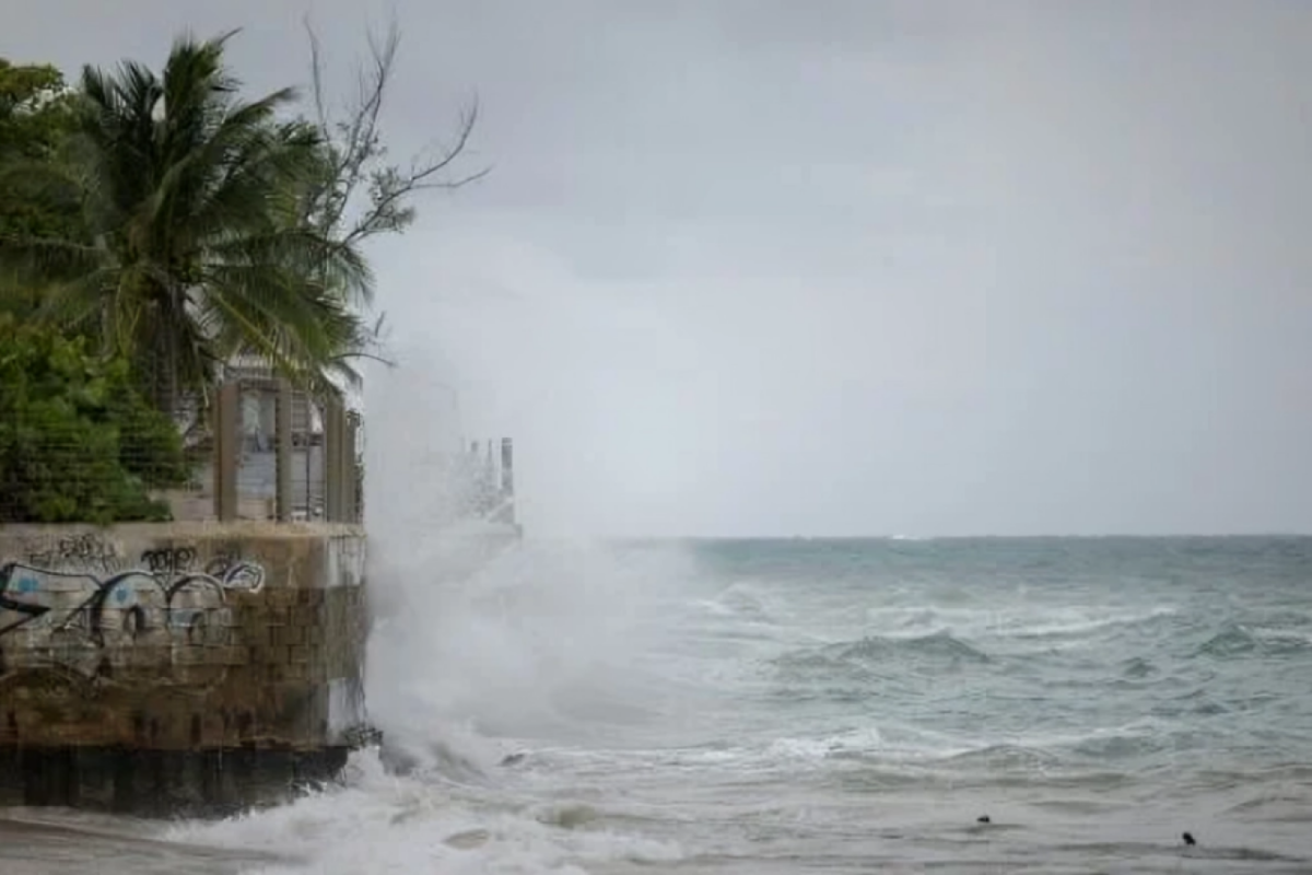
Forecasters do not anticipate a direct landfall along the hurricane’s projected course. However, isolated areas could see as much as eight inches (20 cm) of rainfall, causing significant urban and flash flooding, as well as landslides or mudslides.
The storm reached the highest level on the Saffir-Simpson scale just over 24 hours after becoming a Category 1 hurricane, a rapid intensification that scientists note is increasingly common due to global warming.
“Some increase in size and strength is forecast during the next 48 hours. Erin is likely to remain a dangerous major hurricane through the middle of this week,” the NHC added.
AFP images show surfers riding swells and beachgoers milling about in Luquillo, Puerto Rico, before the storm approached. Flooded roads and homes were reported across the US territory, home to over three million residents.
Swells generated by Erin are expected to affect the Bahamas, Bermuda, and the US East Coast early next week, producing life-threatening surf and rip currents. While Erin is forecast to remain offshore, dangerous waves and coastal erosion may affect areas such as North Carolina.
The Atlantic hurricane season, which runs from June through late November, is predicted to be more intense than usual. Last year, several powerful storms, including Hurricane Helene, caused widespread destruction and claimed over 200 lives in the southeastern United States.
Scientists attribute the increasing intensity and rapid development of storms like Erin to human-driven climate change, specifically rising sea temperatures from fossil fuel emissions.
Meanwhile, the National Oceanic and Atmospheric Administration (NOAA), which oversees the NHC, has faced budget cuts and staffing reductions under US President Donald Trump, raising concerns about potential lapses in storm forecasting.
“Erin demonstrates the ongoing risks posed by climate change, as well as the vital need for accurate and timely meteorological monitoring,” experts note.
Hurricane Erin serves as a stark reminder of the growing threat of extreme weather events in the Caribbean and along the Atlantic seaboard.


Comments