Sunday, 5th July 2026

Khabor Wala Desk
Published: 14th March 2026, 5:24 AM
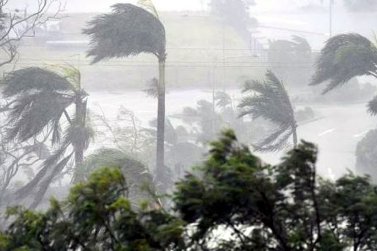
After a prolonged wait, Bangladesh is set to receive a welcome respite as the country braces for the year’s first pre-monsoon cyclone, named ‘Godhuli’.
According to private meteorological monitoring agency, the Bangladesh Weather Observation Team (BWOT), the system is likely to become active over the north-eastern regions of the country from Friday night (13 March). The agency predicts that approximately 40–50 per cent of the country could experience severe thunderstorms accompanied by heavy rain as the cyclone advances.
The cyclone is expected to primarily affect the north-eastern districts, with Sylhet and Mymensingh divisions likely to see prolonged rainfall. Godhuli is forecasted to enter through Sylhet, Rangpur, and Mymensingh divisions on Friday night and may exit the country via the coastal regions around 18 March.
| Division | Expected Impact | Specifics |
|---|---|---|
| Sylhet & Mymensingh | High | Continuous rainfall, multiple severe thunderstorms, occasional hail |
| Dhaka (north-east) | High | Intermittent severe thunderstorms |
| Chattogram (north) | High | Scattered heavy rainfall and thunderstorms |
| Rangpur (north & north-east) | High | Multiple thunderstorms with possible hail |
| Dhaka (rest), Rajshahi, Khulna (north) | Moderate | Active rainfall and isolated thunderstorms |
| Barishal, Khulna & Chattogram (south) | Low | Less active rainfall |
During the cyclone, wind speeds could reach 60–80 km/h, accompanied by moderate to heavy lightning and isolated hailstorms. The northern Bay of Bengal may experience slightly rough seas. Authorities have issued warnings for hilly areas in Sylhet, where heavy rainfall may trigger minor landslides. However, there is no immediate threat of flooding.
Meteorologists note that Godhuli could prove beneficial for the agricultural sector, fulfilling 25–35 per cent of irrigation demand across the affected regions. The skies will remain mostly overcast, providing a cooler and more comfortable climate in northern and central Bangladesh, while the southern regions may experience slightly humid conditions during rain breaks.
The BWOT has indicated that the cyclone will remain active from 13 to 17 March, with the peak intensity expected until 16 March. Farmers, travellers, and residents in the affected areas are advised to stay alert and monitor weather updates closely.


Comments