Sunday, 21st June 2026

Khabor Wala Desk
Published: 21st June 2026, 10:53 AM
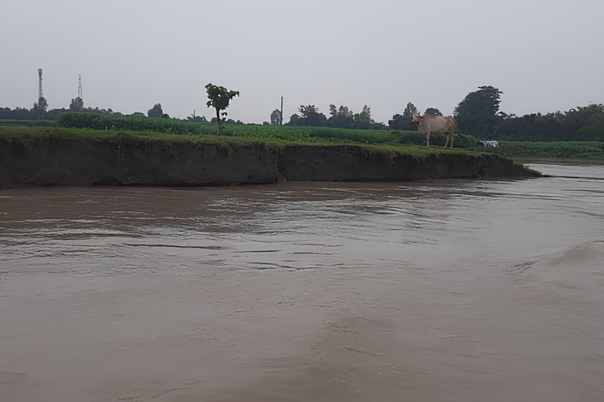
Water levels in several major rivers across Kurigram district, including the Dharla, Teesta, Dudhkumar, and Brahmaputra, are experiencing a gradual rise due to the influx of upstream water and recent rainfall. Despite the increase, water levels across all monitoring stations in the district remain below their respective danger marks. This assessment was detailed in the river monitoring report published by the Kurigram Water Development Board (WDB) at 9:00 am on Sunday. According to the WDB, there is no immediate risk of flooding in the district, though authorities continue to monitor the situation closely.
Data from the WDB report reveals varied water level trends across different measuring stations between 6:00 am and 9:00 am. At the Kurigram station on the Dharla River, the water level rose from 24.20 metres to 24.50 metres, marking a net increase of 30 centimetres. The danger level at this specific point is established at 26.50 metres. Additionally, the surrounding area recorded 30 millimetres of rainfall within the preceding 24 hours.
Similarly, the Dudhkumar River at the Pateshwari measuring point recorded a slight increase. The water level moved from 28.35 metres at 6:00 am to 28.39 metres by 9:00 am. This remains below the designated danger level of 29.60 metres for the station, which received 25 millimetres of rainfall over the last 24 hours. The Brahmaputra River at the Nunkhawa station also showed a marginal increment of 1 centimetre, moving from 23.76 metres to 23.77 metres, well below its danger mark of 26.05 metres. No rainfall was recorded in the Nunkhawa area during the 24-hour period.
In contrast to the rising trends, certain river stations registered minor decreases in water levels. At the Taluk Shimulbari point on the Dharla River, the water level receded by 3 centimetres, dropping from 29.78 metres at 6:00 am to 29.75 metres at 9:00 am, safely below the danger limit of 30.87 metres.
The Teesta River at the Kaunia station also demonstrated a downward trend. The water level fell from 29.50 metres at 6:00 am to 29.30 metres at 9:00 am. The official danger level for this location is 29.31 metres. The Kaunia area recorded 17 millimetres of precipitation over the previous 24 hours.
The comparative hydrological data for the monitored locations is summarised in the table below:
| River and Monitoring Station | Level at 6:00 am (m) | Level at 9:00 am (m) | Net Change (cm) | Danger Level (m) | 24-Hour Rainfall (mm) |
| Dharla (Kurigram) | 24.20 | 24.50 | +30 (Rise) | 26.50 | 30 |
| Dudhkumar (Pateshwari) | 28.35 | 28.39 | +4 (Rise) | 29.60 | 25 |
| Brahmaputra (Nunkhawa) | 23.76 | 23.77 | +1 (Rise) | 26.05 | 0 |
| Dharla (Taluk Shimulbari) | 29.78 | 29.75 | -3 (Fall) | 30.87 | 0 |
| Teesta (Kaunia) | 29.50 | 29.30 | -20 (Fall) | 29.31 | 17 |
Rakibul Islam, the Executive Engineer of the Kurigram Water Development Board, stated that the incremental rise in several of the district’s rivers is a direct consequence of upstream runoff and localised rainfall. He confirmed that because all monitored rivers are currently flowing beneath their designated danger thresholds, an immediate flood threat does not exist. He further assured the public that the WDB maintains continuous, round-the-clock surveillance of the hydrological conditions.

Comments